In the mid-Cenozoic (40 million years ago), the rotation began that led the Corsican Sardinian block to break away from the southern part of France and assume its current position.
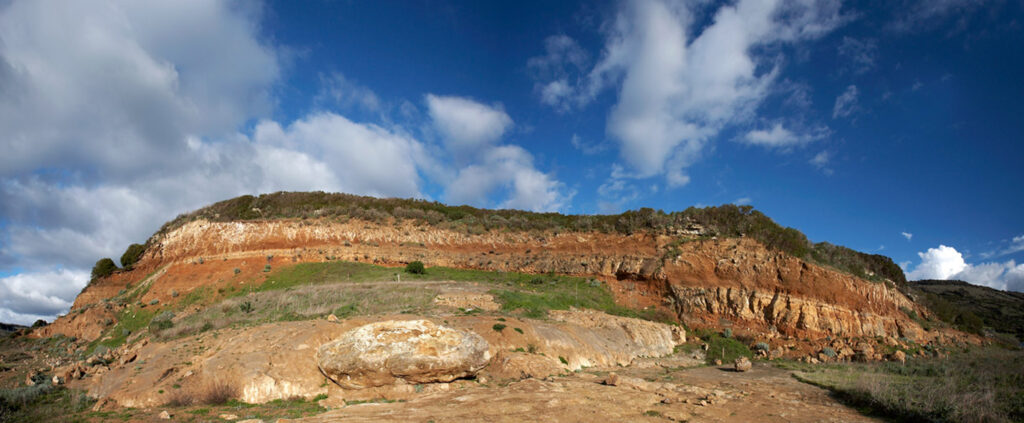
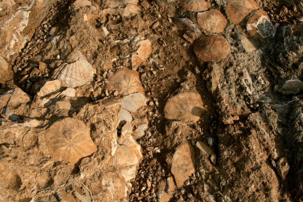
In the Miocene, the sea invaded the Campidano and Marmilla areas, stopping at the foot of Laconi and Nurallao: a blanket of marine sediment was deposited there, which over the centuries became the typical fossiliferous rocks of Marmilla. At the end of the Miocene, the sea withdrew due to tectonic movements and the closure of the Mediterranean.
In the Pliocene (2.5 million years ago), the very fluid lava of Zeppara Manna and Zepparedda flowed out: the basalt, as it cooled, turned into a thick blanket of hard rock that covered the soft marine rocks (marls).
In the Lower Pleistocene, at the beginning of the Quaternary period, at the same time as the volcanic activity, tectonic movements caused the entire territory to be uplifted, and a new tectonic trench was formed in the area between the Gulf of Oristano and the Gulf of Cagliari: the Campidano Graben. The rivers deeply eroded the marine rocks. The great resistance offered by the basalts to weathering preserved the underlying rocks from erosion processes, while those around the flows were deeply eroded. In other words, a reversal of relief took place: where there was originally a vast plain surrounded by relief, the Giara plateau was formed.
In the Holocene, during glacial periods, the landscape of the Giara is distinguished by sparse vegetation on which deer graze. In the warmer phases, on the other hand, the plateau is shrouded in dense vegetation and erosion processes are less intense. In the last epoch of the Quaternary period in which we still find ourselves, man appears.